Disaster Warning Technology and Emergency Response Support
Project Purpose
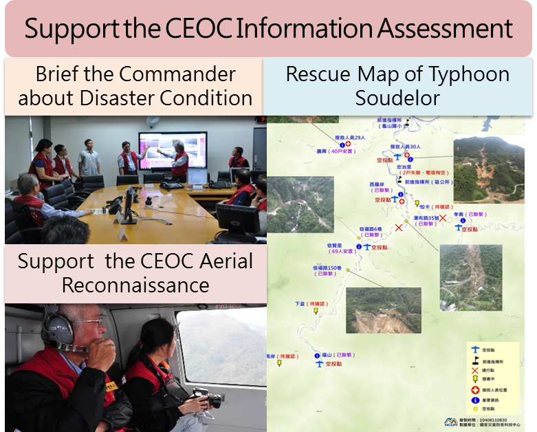
One important mission of NCDR is to support the information assessment of the Central Emergency Operation Center (CEOC) during an emergency response action. In the information assessment team of CEOC, the information that supports decision making is divided into five types, i.e., meteorological information, hydrological information, geological information, disaster, and synthesis analysis. The meteorological information is provided by CWA. The hydrological information is provided by WRA and CPAMI. The geological (including traffic) information is provided by SWCB and DGH etc.. NCDR is responsible for integrating and synthesizing information to provide advices and support emergency operation. So far, this project has established a prototype of emergency operation support, the next step is to improve the capability of information processing and assessment.
The rapid urbanization in recent years has raised the disaster risk in Taiwan. The gust and heavy rainfall associated with typhoon are the most threatening natural hazards that leads to most casualty and economic losses. Hence, to enhance the flood warning capability in the metropolitan area is a high-priority issue in the disaster reduction and prevention in Taiwan. In the near future, three disaster prevention radars will be built in three metropolitan areas, i.e., Taipei, Taichung, and Kaohsiung. This project aims to help effectively use science and technology to support the decision making of disaster emergency operation and disaster management.
With the build-up of monitoring and surveillance equipments such as radar systems, this project aims to integrate the current disaster prevention technologies as well as plan the strategy for disaster prevention and management to enhance the capability of flood warning for metropolitan areas in Taiwan. Through raising the early warning capability and adjusting the local disaster prevention operation, this project hopes to strengthen local governments’ capabilities to respond to disasters and take emergency actions to ensure the safety of people's lives and property.
In researching and developing these technologies, this project also has close collaborations with academic institutions, operational centers, or government organizations to help reach the goals.
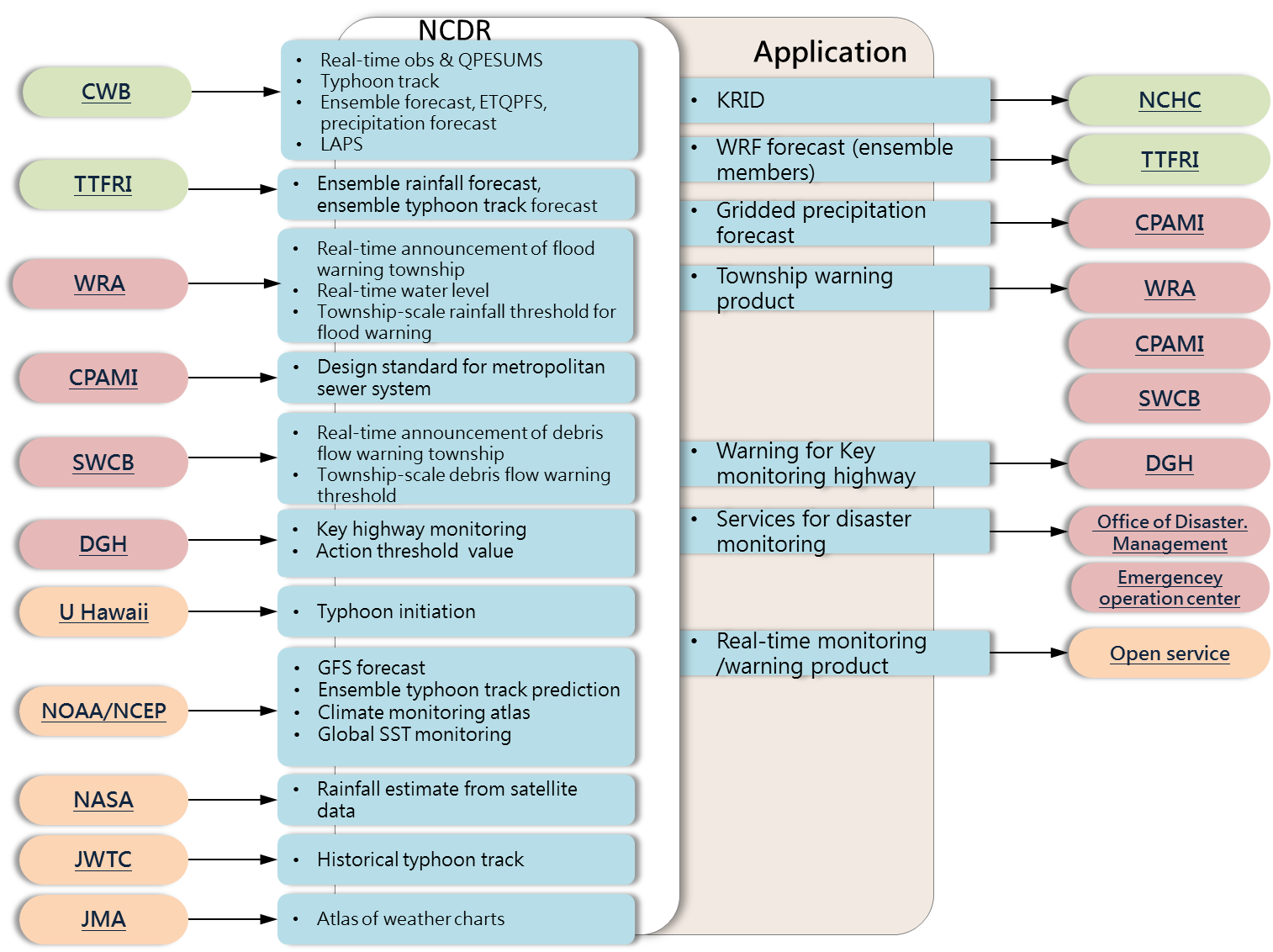
Fig. 1. Collaboration with other organizations
Primary Tasks
The current goal of this project is to promote the development of flood warning technology in metropolitan areas and to implement application of research results on disaster emergency operation. Along with the establishment of disaster prevention radar system, the project will develop high spatial-and-temporal resolution disaster prevention warning technology to fulfill the needs of disaster early warning and emergency operation particularly for the highly populated metropolitan areas. This project will continue to support the information assessment work of CEOC and provide reviews and advices on emergency response operation.
- Support, review, and improve CEOC information assessment work
- Promote the development and application of flood monitoring and warning technology in metropolitan areas: research and development of high resolution meteorological disaster monitoring and warning technology as well as the products to support emergency operation
Key Achievements
- Supported 9 CEOC Emergency Response Actions
- CEOC aerial reconnaissance (WuLai and San-Xia areas)
- Disaster area identification (5 areas) from satellite images during Typhoon Soudelor
- Disaster rescue map producing (8 times) and disaster management capability enhancement
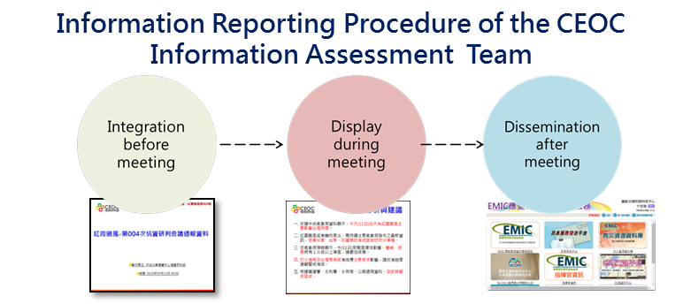
- Improved Information Reporting Procedure
- Unified the format of information assessment presentation files
- Improved information integration and reporting procedure
- Provided information to the local government through four different ways (EMIC, email, Fax, and EOCDSS)
- Shortened the information dissemination time to raise the efficiency
- Raised the Efficiency of Information Integration in CEOC Information Assessment Team
- Raised the information integration rate from 71% in 2014 to 88% in 2015
- Impact Assessment under Disaster Scenario
- Integrated the disaster warning technique developed by slopeland & hydrology division and loss assessment technique developed by policy and socio-economics division to develop scenario-based disaster impact assessment technique
- Interdisciplinary Disaster Early Warning
- Automatically integrated the meteorological, hydrological, and geological warning information
- Practically applied disaster warning techniques developed by other organizations to interdisciplinary early warning and impact assessment techniques
- Provided 19 meteorological, disaster warning, and impact assessment information services, including 7 services through Integrated Platform on Information and Intelligence of Disaster