2012 International Training Workshop on Application of Information Technology on Disaster Risk Reduction and Emergency Preparedness
2012.05.14
The primary topic of 2012 ITW is “Application of Information Technology on Disaster Risk Reduction and Emergency Preparedness.” The program emphasizes on the development of gathering information throughout the nation, strengthening environment monitoring capability, and on developing analytical techniques for potential disaster, to integrate static and dynamic international/domestic data for constructing an information system that supports all levels of the authority and (NGOs) in the purpose of identification, analysis and decision‐making at different phases of disaster. Therefore, this workshop will provide a platform for participants to exchange and share the experiences as well as the technology on disaster preparedness, mitigation, and relief. The 2012 ITW includes planning, problem solving, and future work concerning information systems for disaster preparedness and relief. Integrated data required in the synergy include basic digital maps of topography, geology, hydrology, land use, population, transportation and pipelines as well as environmental monitoring data such as humidity, precipitation, river status and so on. For various purposes, the information systems can be designed to support decision making at central and local levels or as specific disaster warning systems for flooding, debris flow or highway damages for ministries and industries. Innovations such as GIS analysis systems and emergency intelligence from remote sensing are also introduced in this workshop. The proposed workshop stands the prospect of enhancing trainees’ capacity of identifying problems as well as solving problems via intensive discussion, experience sharing, and hands‐on exercises.


Download
2012 ITW Agenda
Pacific Disaster Center: Applying Information, Science and Technology in Support of Disaster Resiliency (Chris Chiesa, Deputy Executive Director, Pacific Disaster Center)
The Information Appetite (Manu Gupta, Chairperson of Asian Disaster Reduction & Response Network)
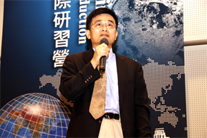
Overview of information technologies on disaster risk reduction and emergency preparedness (Hseuh-Cheng Chou, Division Head of National Science and Technology Center for Disaster Reduction)
Introduction of Taiwan Climate Change Projection and Information Platform Project (TCCIP) (Huang-Hsiung Hsu, Research Fellow of Research Center for Environmental Changes, Academia Sinica)
FORMOSAT-2 in Support of Emergency Response
FORMOSAT-2 in Support of Emergency Response (Bo Chen, Division Chief of National Space Organization)
Towards the Development of NGIS (Jung-Hong Hong, Prof. of Department of Geomatics, National Cheng Kung University)
What Kinds of Geological Hazard Data in CGS' Database (Li-Yuan Fei, Division Chief of Central Geological Survey)
Applying Severe Weather Information to Disaster Prevention (Yeu-Woo Lin, Director of Planning Division, Central Weather Bureau)
Taiwan's Response Action to Flood Prevention (Ming-Chang Shieh, Director of Water Hazard Mitigation Center, WRA)
Early Warning System and On-site Observation of Debris Flow Disasters (Hsiao‐Yuan Yin, Section Chief of Soil and Water Conservation Bureau)
Demonstration of Road Safety Assessment (Early Warning System Application) (Chin-Fa Chen, Directorate General of Highways)
2012 An open and interoperable disaster management system for Big Data (Tien-Yin Chou, Director of GIS Research Center, Feng-Chia University)
3D GIS Taiwan on Cloud Service (Whey-Fone Tsai, Research Fellow of National Center for High-Performance Computing)
Technology, Disaster Management and the Future (Dr. Jemilah Mahood, President of Mercy Malaysia)
Building resiliency, providing response and driving recovery in times of mass-collaboration and networked intelligence (Gisli Olasfsson, Emergency Response Director of NetHope)
Crowdsourcing and Open Platform for Disaster Management (Slayer Chaung, Manager of Department Manager, Academia Sinica/ITRI)
Rajamangala Universityof Technology Lanna (RMUTL), THAILAND
REPUBLIC OF PANAMA MINISTRY OF GOVERNMENT NATIONAL CIVIL PROTECTION SYSTEM (SINAPROC)
Tropical Storm Sendong (Dr. Ando Siringan, MSI, Manila Observatory)
Manila Observatory (Philippines)
Organized by National Science and Technology Center for Disaster Reduction, Taiwan, R.O.C. (Thanonnat (Korn) Jaroenwimonnaragul, Director of Technical and Disaster Warning System Development Group)
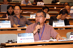
The DENR-MGB Geohazards Mapping Program – Minimizing Risk on Disaster For Safer Communities (CARLOS A. TAYAG, Regional Director, MGB Regional Office No. I)
THE USE OF ICT IN DISASTER MANAGEMENT THE MALAYSIAN EMERGENCY COMMAND CENTER PROJECT (Khajril Hilmi Mokhtar)
INTRODUCTION TO MERCY MALAYSIA (Edward Hew Cheong Yew)
Lesson learn on Application of InforTech on Disaster Management in Vietnam (Bui Quang Huy, Chief of Information and Statistic Division)
Hands on exercise—Hazard Map and its application (Chy-Chang Chang, Google Earth Basics/ Tingyeh Wu, Potential Map)